
Aerial Imaging Solutions
Our Services

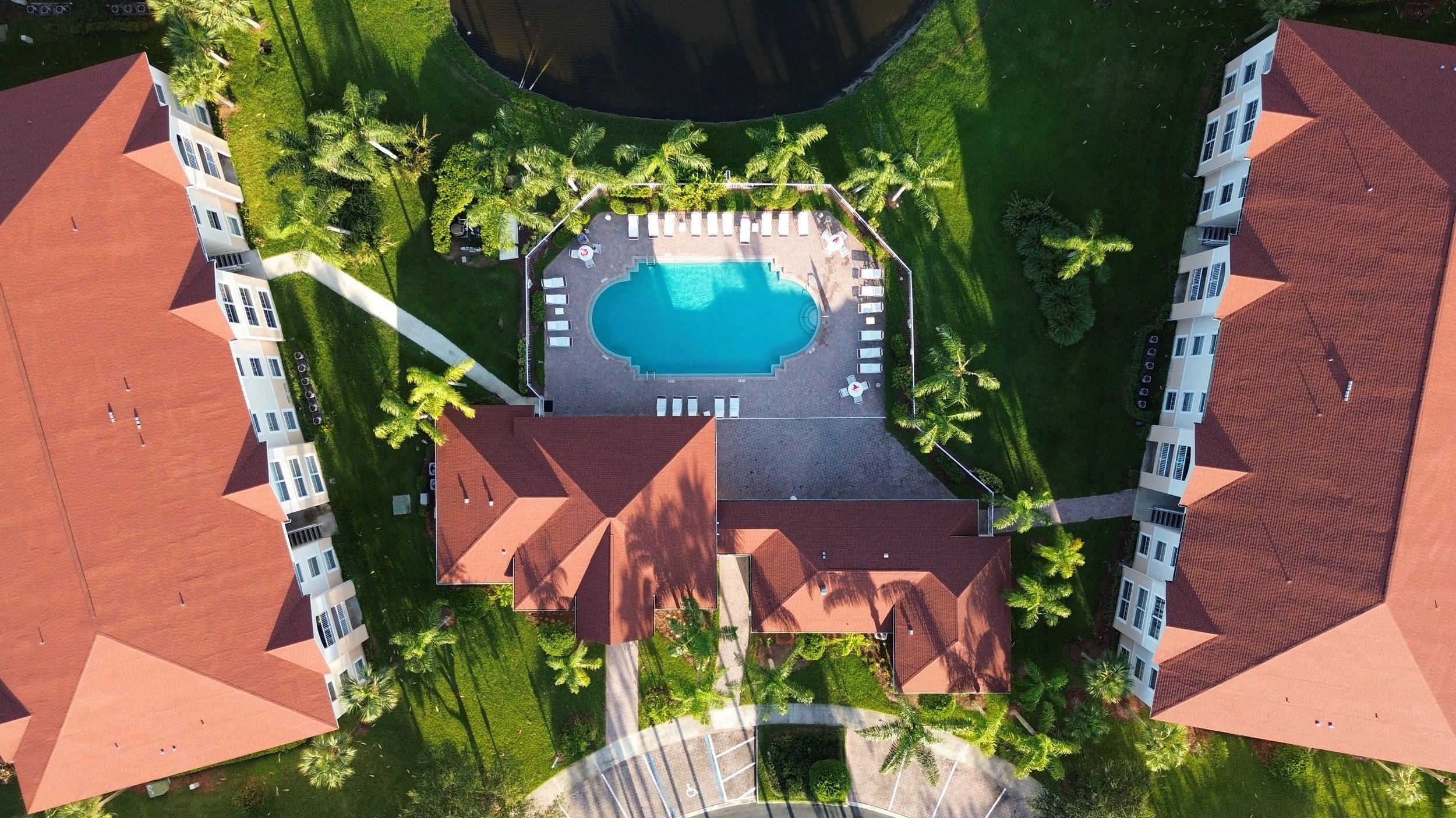
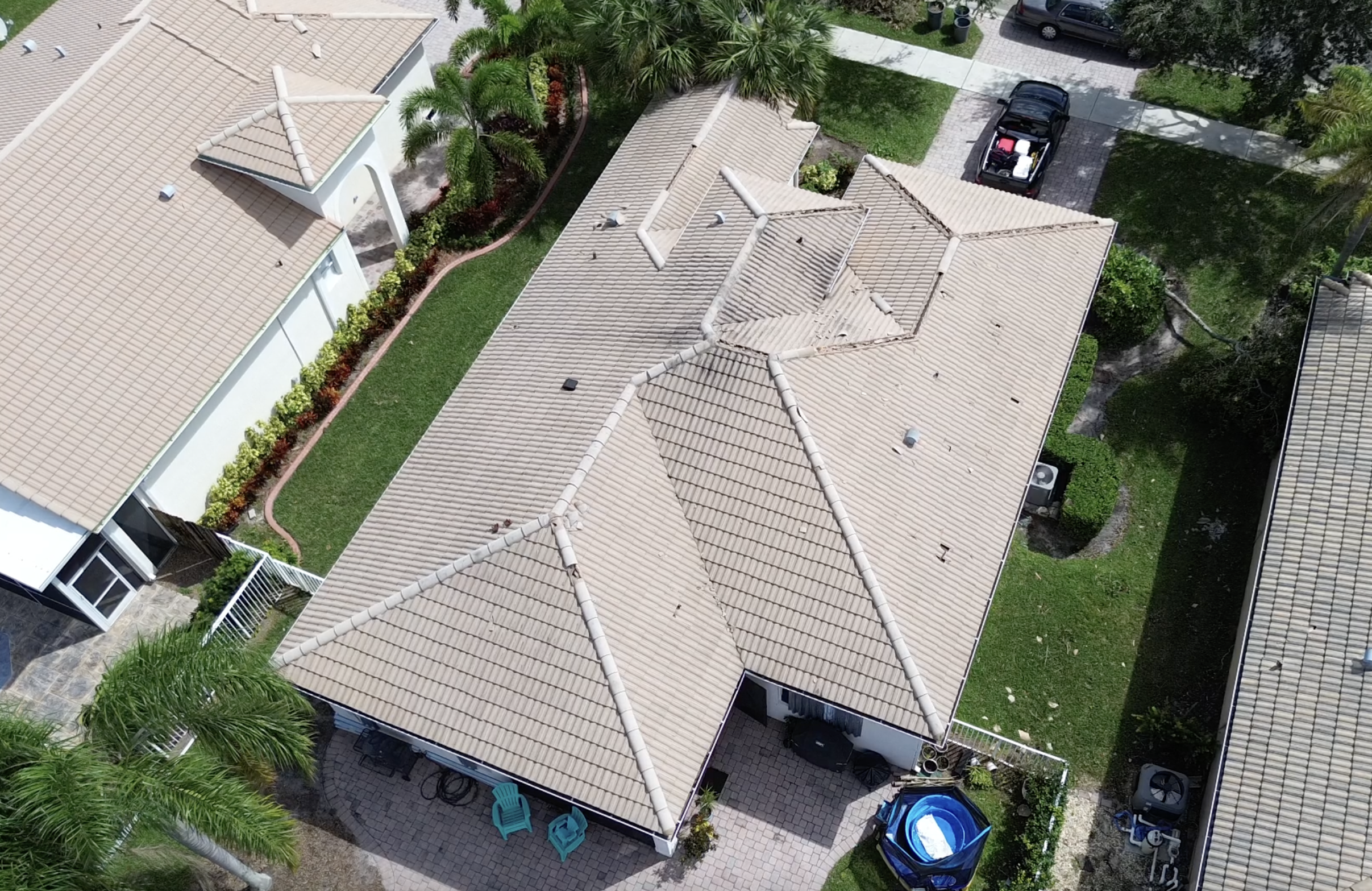
Private & Commercial Real Estate
Elevate real estate listings with aerial Imaging. Our drone services capture high-quality, dynamic shots that showcase properties from every angle. Highlight the location and potential of your real estate, and stand out in the competitive market.
Orthomosaic, 3D Modeling, & Construction Progress Monitoring
Unlock the power of orthomosaics, 3d modeling, & aerial progress monitoring services. Using cutting-edge drone technology, we create accurate, high-resolution maps and models for industries like construction, real estate, and more. Maps and models are a great resource for keeping track of assets, stockpile measurements, and progress monitoring.

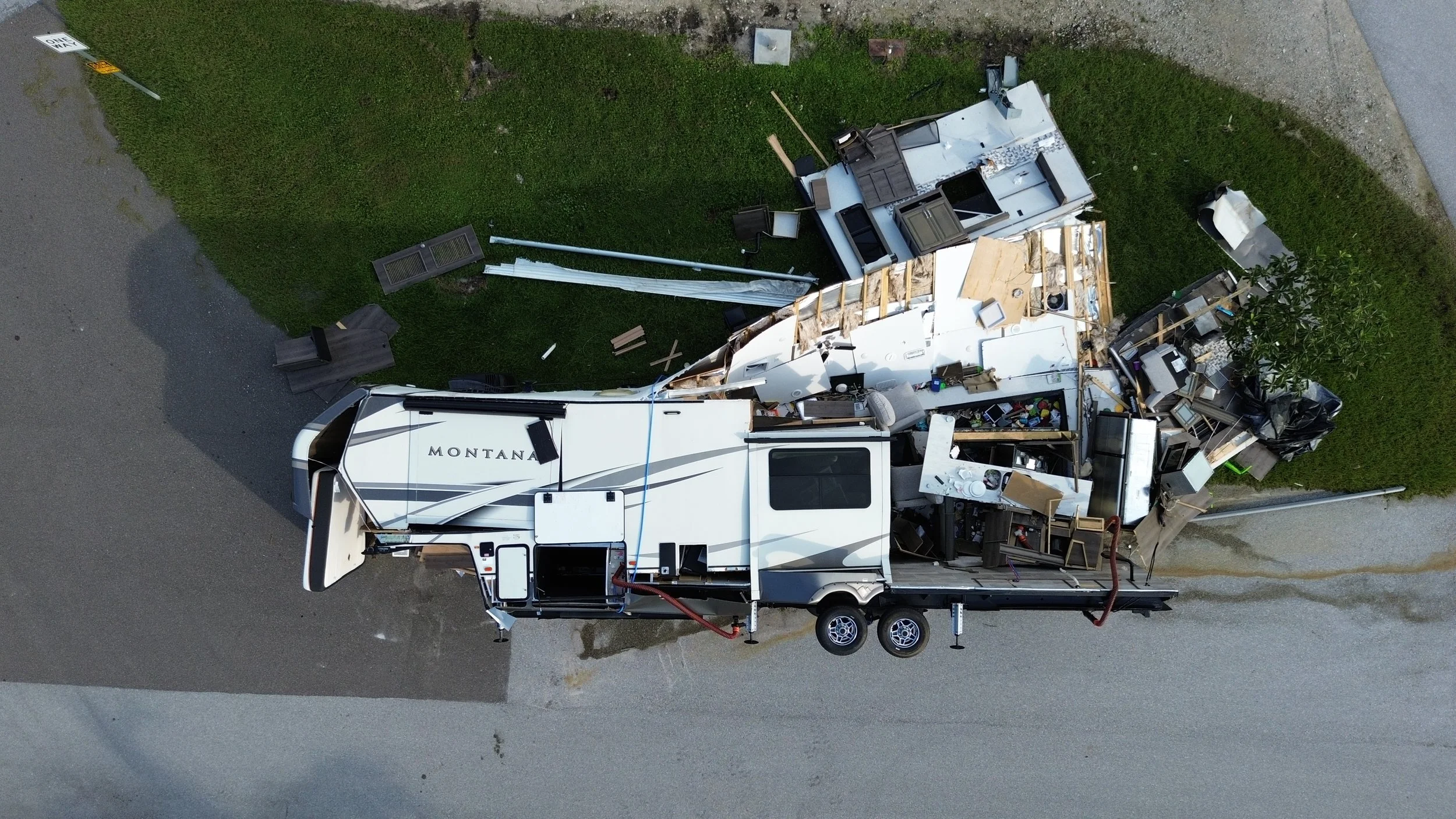
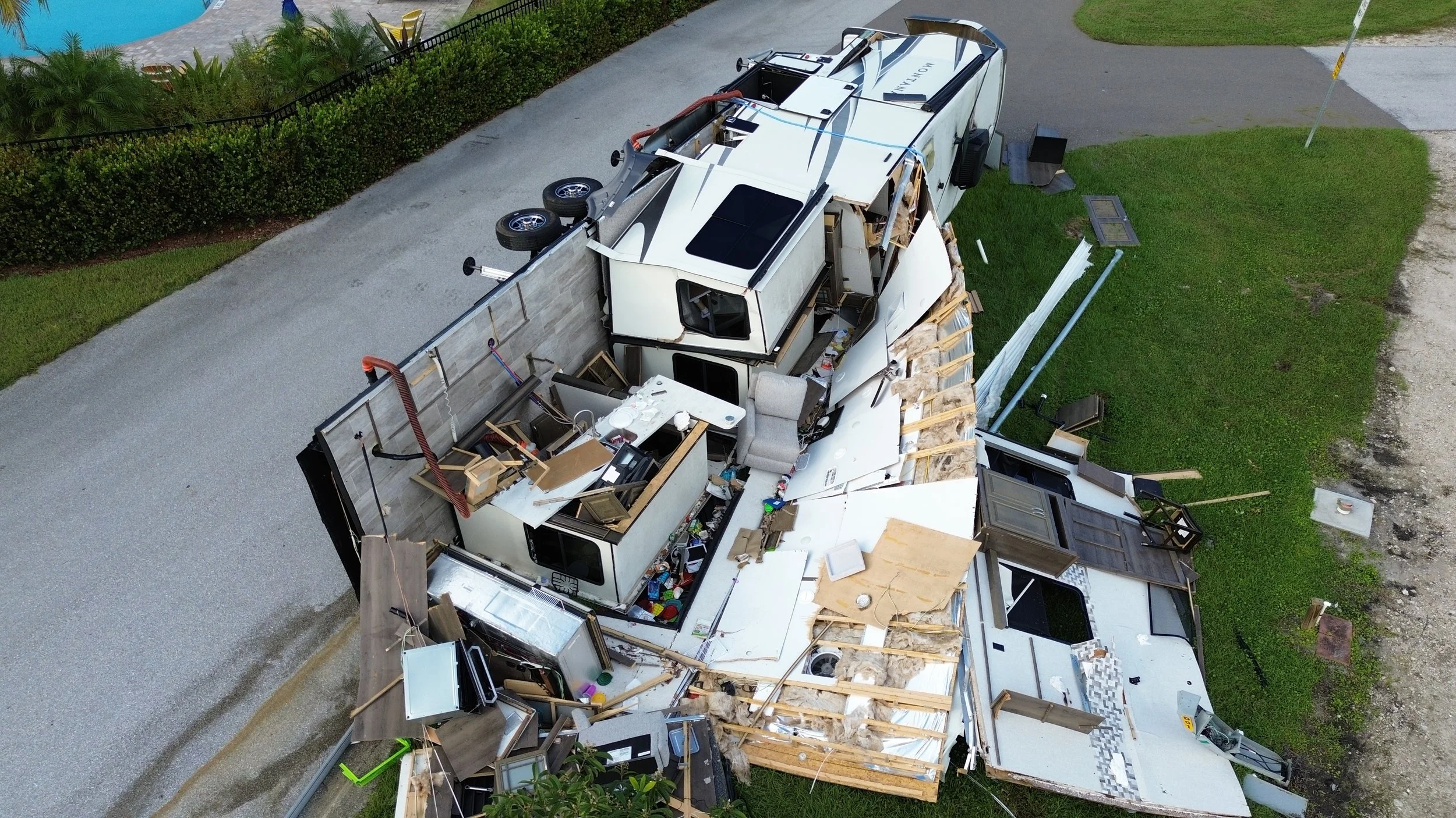
Post Natural Disaster Services
In the aftermath of natural disasters, our drone services can provide crucial support by capturing real-time aerial footage of affected areas. With the delivery of clear visuals of damaged properties and hard-to-reach locations we aid in quicker assessments and recovery efforts. Our drones offer a safe, efficient way to gather vital information for disaster relief and rebuilding efforts.
What to Expect
-
Discuss Your Project Details

-
Quotation

-
Flight Planning

-
Schedule Project Date

-
Receive Your Data

Portfolio
-
![An aerial view of a residential complex with red-roofed buildings, a central swimming pool surrounded by lounge chairs, green lawns, and palm trees.]()
-
![Aerial view of a damaged Montana RV parked on the street with debris and furniture scattered around, with grass and a gravel area nearby.]()
-
![A partially destroyed RV with significant interior damage and scattered debris on the lawn and street.]()
-
![Aerial view of residential houses with tiled roofs, landscaped yards with palm trees and bushes, parked cars, a small patio with chairs, and a backyard with a blue inflatable pool.]()
-
![Aerial view of residential neighborhood with multiple houses. Several roofs are covered with blue tarps, indicating storm damage or construction. The street runs through the middle, lined with trees and parked cars. Some damaged trees are visible, with debris scattered in yards.]()
-
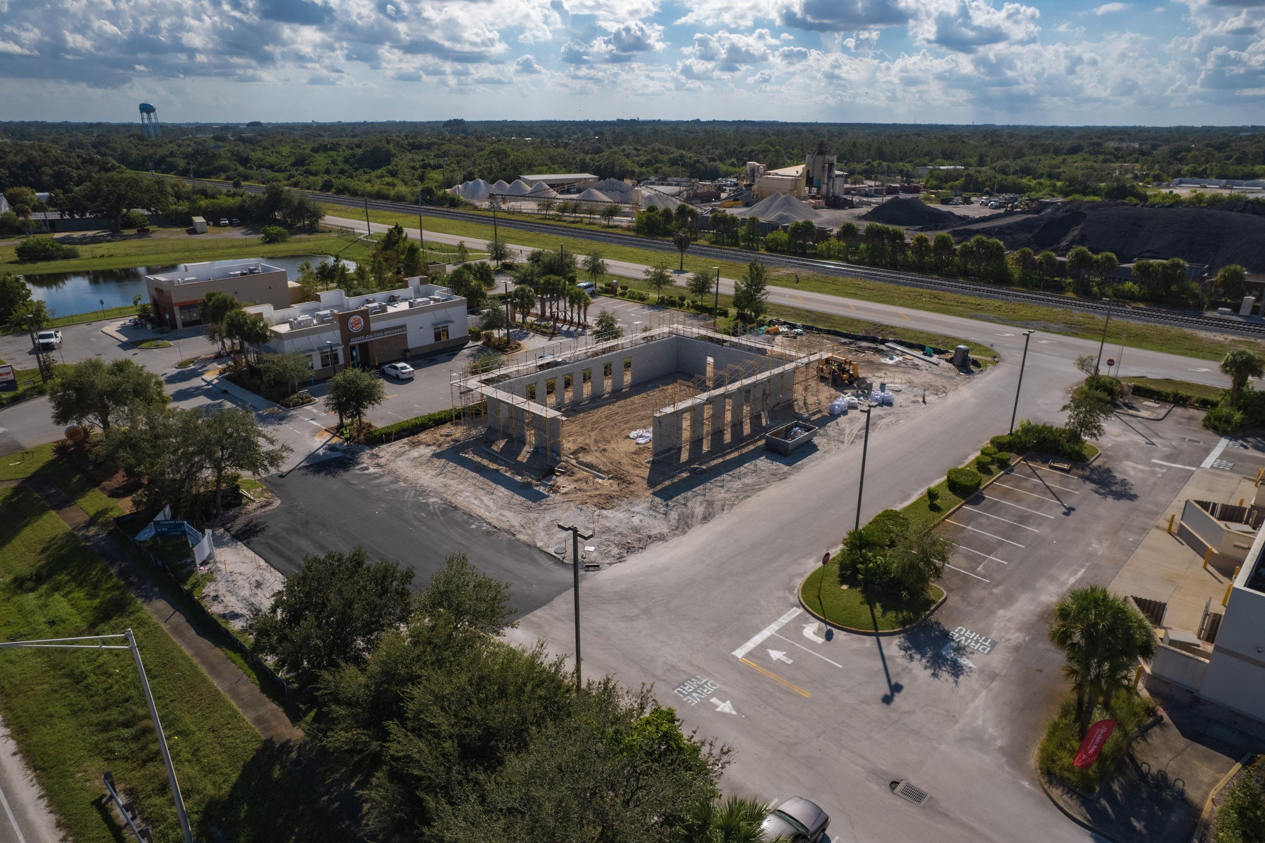
![An aerial view of a construction site with partially built wooden framework, surrounded by parking lots, commercial buildings, trees, and a nearby water tower under a partly cloudy sky.]()
New List Item

About
Our Company
At VenturAir, our mission is to provide the community with high-quality aerial imagery that transforms how businesses and individuals view their projects. We specialize in orthomosaic mapping, delivering precise, detailed data to support real estate and construction projects. Whether you need accurate terrain mapping, 3D models, or site inspections, our drone services provide invaluable insights to enhance decision-making and streamline operations.
Serving the real estate and construction sectors, we combine advanced drone technology with excellent customer service to deliver results that help you make informed decisions. With an extensive background in aviation, our founder's passion for flight naturally expanded into drone technology, allowing us to harness these tools to serve industries that greatly benefit from aerial perspectives and data.
Whether you are looking to monitor construction projects or need detailed mapping for development, VenturAir is committed to offering quality, reliability, and innovation in every flight.

Licenses & Certificates
-

14 CFR PART 107 sUAS
Federal Aviation Administration
-

ICS - 100 & ISC - 700
Federal Emergency Management Agency
-
10 - Hour Construction
Occupational Safety and Health Administration

Contact Us
Interested in working together? Fill out some info and we will be in touch shortly. We can’t wait to hear from you!